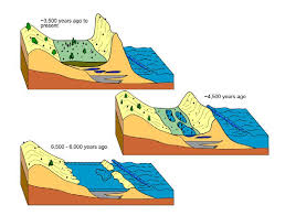
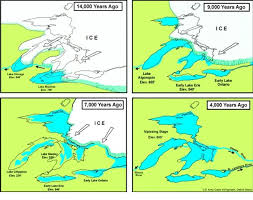
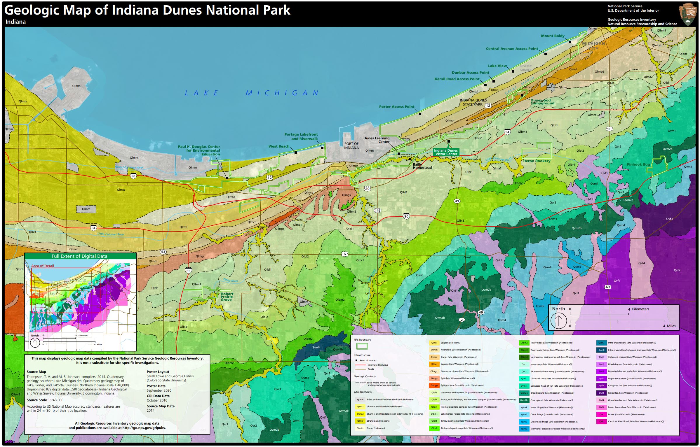
Indiana Dunes National Park is located in a unique geologic setting at the southern apex of one of America’s largest freshwater supplies. The result of a melting glacier of ice, Lake Michigan is one of the last reminiscent of the Ice Age to northwestern Indiana. The expansive beach, rolling dunes, and wide wetland features illustrate the effects of water, wind, and vegetation growth is reshaping the surface of the land since the departure of the glacier from this region about 18,000 years ago. The shoreline as we know it, began when a small ridge of sand and gravel developed as lake levels rose about 6,000 years ago. At 4,500 years, the water level in Lake Michigan dropped and sand was exposed and swept into U-shaped dunes and foredunes. During the past 3,500 years, these dunes have migrated and new ones have formed, shaping the landscape into its beauty today.

Mount Tom and Mount Baldy are the two summits of Indiana Dunes National Park. Mount Baldy is along the shores of Lake Michigan. It’s a grand total of 126 feet above Lake Michigan. Mount Baldy is moving inland at a rate of approximately four feet a year. This movement has obliterated the short, southern route to the summit.


The lee sides of the Indiana Dunes include a number of seasonally intermittent ponds, with plants that have evolved to thrive in places that are alternately wet and dry.

The Great Marsh Landward of Tolleston Beach is an interdunal wetland area called the Great Marsh. Initially a shallow, open-water lagoon, this area changed into a series of isolated marl ponds that vegetated over during the fall from the peak lake level at 4,500 years ago.

This entry is licensed under a Creative Commons Attribution-NonCommercial-ShareAlike 4.0 International license.